Saturday, June 28, 2008

Did Miss Kitty Sleep Here?

Dinosaur, Colorado is one of those border towns most folks drive through without realizing it has come and gone. Even with its one-of-a-kind name, Dinosaur is not a destination resort stop. When I was a kid riding in a 1948 Chevrolet we always stopped here for radiator water. No need for that these days.

But on this day I noticed a fancy new state tourist office just back from Highway 40 and I wondered if they sold fishing licenses, so I went in. Well, plus I had to see a man about a horse, you know.

The gal behind the counter turned out to be chatty and seemed friendly. I asked her about the ranch house I’d seen that seemed parked just inside the Colorado border. I was angling to get the names of the owners so I could ask for permission to cross any of their land that might straddle the line.

Oh, she said, you mean the K Ranch?

I allowed that I probably did. I find it regrettably easy to drop into almost any local vernacular.

Why sure, she said. That’s Mike and Norma’s place. Well, it isn’t but they manage it, you know. Say, did you know that Amanda Blake, you know, Miss Kitty from Gunsmoke owns that place? Well, of course she’s dead now but I mean, so her estate must, or family, or the like, you know.

So I drove out to Mike-Norma-Miss Kitty-Miss Kitty’s family place. The driveway was long and dusty. Not a driveway really, more like a mile or so of dirt road.

A spry looking silver-blue haired woman opened the door when I finally got past the yard dogs. She looked up straight into my eyes.

No, she answered my question with a pleased laugh. Norma’s my daughter and Mike’s off into town doin’ whatever. I explained my mission. She looked down at my Croc®-clad feet and then back up into my eyes. You best ask Mike on that, she said, but she smiled.

So I got a phone number and an address and when it comes time to walk north from Highway 40 I’ll be calling Mike to see if he’ll join me. Or better yet, he and Norma and Norma's mother. My research so far on Miss Kitty has not turned up any ownership records for the K Ranch but some darned interesting stuff on Miss Kitty.

I’d like to see what Mike knows about what those town folks in Dinosaur are saying about his land.

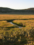
K Ranch from the air

Snake John Reef can also be seen on this map. Go south from the ranch and check for the uplift feature running from the northwest to the southeast. The Colorado/Utah border runs north and south in a straight line just to the west of K Ranch.

Wednesday, June 25, 2008

Black Plague Update

The empty white-tailed prairie dog communities around Snake John Reef on the Colorado/Utah border may not be as empty as they appeared.

I contacted sensitive species biologist Brian Maxfield with the Utah Division of Wildlife Resources today. He thought the communities were doing pretty well.

Maxfield speaks like a man dedicated to his profession and someone who knows what he is about. He added some new information to the more dated reports we recently commented on here.

Maxfield told me his team released 31 black-footed ferrets into the Snake John Reef area rather than the 10 noted in the Deseret News story, 10 of which had been inoculated with the sylvatic plague vaccine.

Badgers and coyotes, who also inhabit these borderlands, are more likely to decimate larger prairie dog communities than ferrets, he said. The black-foots will move to another colony long before their food supply diminishes to a critical point.

I was happy to learn that prairie dogs have not been neglected in the fight against sylvatic plague either. Maxfield said an oral vaccine has been developed that can be spread over feeding areas and ingested by the dogs. Tests for that vaccine are ongoing and as yet inconclusive.

I also learned from Maxfield that all these vaccine tests are actually under the direction of the U.S. Army, which he said handles all plague research. He also said it was the U.S.G.S. that got his research data first.

Maxfield said he was currently busy working on a study of flying squirrels in the Uinta borderlands area so he had been spending his days in higher country lately. The Northeast Regional Office of the Utah Division of Wildlife Resources will conduct a “poll” of the black-foots at Snake John Reef in August and I wangled an invitation to tag along. The teams begin after nightfall looking for what Maxfield called eyeshine. When they catch a ferret they identify it by virtue of a subcutaneous tag implanted earlier and log its health data.

I hope Maxfield is right about those prairie dogs being okay at Snake John Reef. I will be able to make a personal report after my August ride-along. All I have now is the attached video (No Dogs) of the empty mounds. Compressing the file to fit here as video compromised its clarity, but you should be able to see what I mean.

I also admit I’m a little worried when I hear that yet again their distant cousins are getting more attention.

Monday, June 23, 2008

Black Plague and Snake John Reef

Nobody was home.

It was a huge community -- signs of construction everywhere. And yet no eyes looked out, no sounds of alarm, no watchers.

The east side of this part of Snake John Reef on the Colorado/Utah border showed not a living prairie dog watching from any of the hundreds of burrows scattered across the dry grasslands when I walked this area during the last of May this year. Finding out why is one of the rewards of walking these borderlands.

It turns out parts of Utah, Colorado and other western states have been experiencing an uptick in sylvatic plague, what a Utah State biologist called "the prairie dog version of the black plague" (Deseret News and Utah Wildlife Division).

Prairie dogs, though, are low on the social ladder for ranchers and others who scrape a living from these parts. The white-tailed dogs Cynomys leucurus that inhabit this section of borderlands apparently haven't risen much higher. The furry barkers are related to squirrels but are basement dwellers unlike their high rise cousins. Horses and cattle can break a leg crashing through the rooftops and worse, these dogs eat grass. There's not much of that to go around.

It's not all bad news out by Snake John Reef though, thanks to some other, more highly esteemed residents. Those would be the once "most endangered mammal on earth," the black-footed ferret, which, incidentally, has a singular appetite for prairie dog. That means the ferret also gets the plague.

The rarity of the ferret merited a special effort to develop a vaccine that would keep it from being wiped out. The 16 fortunate prairie dog colonies in the Snake John Reef area were blessed to have the company of 10 black-footed ferrets, half of which were vaccinated, half not. The idea was to see if the vaccinated ferrets beat the plague. The prairies dogs were apparently not consulted.

On both sides of the fenceline that tracks the state border are vacant mounds. Ferrets are nocturnal critters and a watcher wouldn't expect to see any in the daylight hours. But the neighborhood would have a guard dog yipping a warning in strategic locations, and a few gleaners scurrying through the grass and saltbush.

That day there were no yips, no watching eyes, no furtive dashes for cover. Just the wind at Snake John Reef.

To be continued
...

Saturday, June 21, 2008

Which GPS unit to use?

A good GPS handheld unit is critical to borderline traverses. The whole idea is to walk the border in a line that matches the border itself, recording way points as a verification. These borderline walks are far from easy, especially on straight line borders that make no leeway for the topography or plant life and rivers. Some variations are inevitable but the idea is to stay on the borderline itself as accurately as possible and record some of the difficultieis in doing so. Here is a link to one of the best sites I've run into for analyizing GPS units. GPS There are some others and hopefully readers will add their own comments on their own experiences with various models.

Friday, June 20, 2008

Map Mystery


The comedian Stephen Wright once told an audience he had the most accurate map in the world. "But it is a 1:1 scale so it takes a very long time to unfold."

Maps are a key component of the Borderlands Project. Together with a good GPS unit they are one of the necessities...right up there with a good snake-bite strategy. In the age of satellite photography and Google-Earth we have come to think of ourselves as the proud possessors of the most accurate maps in the world. But are we?

Check out the picture of the Marshall Islanders map on this page. It is reproduced from a 1938 edition of General Cartography by master topologist Erwin Raisz. It is constructed from shells and sticks that partly provide support and partly show the prevailing curvature of the wave fronts. These island voyagers used this sort of map to traverse the expanse of ocean that separated their island destination points.

Another insight into the diversity of map making and way finding can be found in the description by Eric Hansen of his experience in the rain forests of Borneo (Stranger in the Forest). Hansen had a map, the kind most of us are familiar with, but had extreme difficulty getting his guides to tell him exactly where they were or how long it would take to get to the next camp. His Penan guides (a forest tribe highly regarded for their abilities in the Borneo rain forests) navigated by the direction of streams or by where a certain vine grew on a tree, they told him. Hansen measured the journey in hours and minutes and the difficulty of the route. His guides measured the journey by how good the hunting was. For instance, if the hunting was good in an area it may take them five days to traverse it because they spent time tracking and hunting. If game was scarce they might traverse the same route in a day or less to get to where the hunting was better. The route also depended on mood or need so a reference to a destination "not too far away" may relate to it being a place where good tobacco could be secured from a friend. The fact that it took five walking days was not a factor.

Thursday, June 19, 2008

Motorized or not?

We have had some input on whether motorized conveyances are acceptable for traverse teams. The guidelines currently ask for non-motorized transport. This is meant to encourage both a closer connection to the boundary country and more eco-friendly traversing. The guideline is also meant to make getting permission from property owners easier to secure.

Tuesday, June 17, 2008

Who owns the West?

Common wisdom has it that the West is owned mostly by the Federal Government in one or another of its forms. While this is true for the most part western land ownership teams who traverse the state borders will find that a surprising amount of that land is in private hands. Contacting owners for permission to cross private land is a tenet of the Borderlands Project. That means in many cases finding out what land specifically is public and what is private. It also means finding out who those owners are.

The United States Geological Survey publishes what are called Surface Management Status maps in 1:100,000-scale topographic versions that show land ownership (maps). This link is the best search-able site on their website. Click on the state then type in Surface management status.

When teams need to drill down further for specific owners and property divisions, they will need to contact the county assessor's office for the county along the border they are traversing.

Monday, June 16, 2008

Center of the American West

The Center is associated with the University of Colorado Boulder. One way to think about its work is to make a list of all the issues that affect living in the West that the perfect western Governor would really have to know about to do a great job. Many of these issues are unique to the West or unique in how they play out in this part of the country. The Center brings people together in a variety of ways for dialogue on those issues with the idea that it will lead to better policy and better living.


Thursday, June 12, 2008

No Video...But Watch Out Up The Road!

I wanted to attach or at least link a video record of a sample traverse done on the Utah/Colorado border where U.S. Highway 40 crosses. But I haven't yet figured out the how-to so I'll just post some narrative about it. I did this traverse in May of 2008 traveling from north to south on the following waypoints moving from start to finish of the traverse:

N40 16.385 W109 03.052
N40 15.978 W109 03.056
N40 15.736 W109 03.059
N40 15.596 W109 03.056

I was able to set the second waypoint directly on a USGS Survey Cap.

The video I made was a pretty horrible first effort. It could have been tightened up with a voice-over narrative but I wanted to present a sample as close to the actual video filming as possible. I did do minor edits but it was still long and rambling. Probably better to chalk it up to a learning experience.

Wednesday, June 4, 2008

Post # 1 - What's going on here?

I have begun this blog under the auspices of my newly formed company, Passy Cassini & Associates, but it may not end up that way. I am a recovering journalist and newspaper owner (small weeklies and business journals in the western states). This blog is part of my desire to do what I love in a different way. The idea of Traversing Borderlands is to record the experiences of many people who will hopefully answer the challenge of traversing the actual borders of our country's states and will record their experiences here and on a companion website.

The idea grew out of an old notebook entry I found in my idea file during the gray period after selling my newspapers as I was wondering what would come next. The scribbled entry simply said, "walk the borders of a square state."

Of course there aren't really any square states. I must have been thinking about Wyoming or Colorado, the two that come the closest. But I started to dig into the idea and became more intrigued as I did.

Western states in particular, but not exclusively, stand out on a map for their straight lines. Who decided, and why, to drop these straight lines on the borders. What kind of consequences did and does that have for people, plants, animals, resources, businesses, watersheds -- the whole range of entities that populate and are affected by the borderlands? Was there any rhyme or reason to it at all?

I started to think also about other areas of the world -- the Mideast in particular -- where the relatively recent drawing of arbitrary borders has had far-ranging consequences. And that borders aren't just geographic but social, political, psychological, intellectual, linguistic -- it goes on and on.

As a 30-plus year journalist and struggling owner for the past ten years, I was also frankly burned out on the news business as it is. But I am still impassioned about what it could be. The traditional definition of news, how we track it, who gets to create and distribute it, how it gets subsidized (some might say bastardized) by total dependence on advertising -- this stuff kept kept knocking up against the interests of real people I talk with every day.

The old news paradigms also seemed contrary to how real people actually learn about the things that are important to them.

I have been intrigued by William Least Heat-Moon's description of his book, PrairyErth." He called it a "deep map" of Chase County, Kansas. That is how I envision Traversing Borderlands.

I'm new to blogging and the community out there, unmet as yet. But I think this first post is too long already so I'm going to close now and add more in following posts. I'll include the preliminary outline of how the project works, sponsors, all of that. But in the meantime I'll be interested to see what kind -- if any -- input comes this way. I believe Traversing Borderlands could be a mother lode for deep mapping.

bt+editor