August 15, 2008 - Friday
Driving south on Highway 93 from Twin Falls, Idaho toward Wells, Nevada is hot work in August. The air conditioning in my truck hasn’t worked since I bought it. You pay $3,000, you take some chances.
The map shows a maze of roads leading eventually to the northwest corner of Utah. Or the northeast corner of Nevada. Or the southern border of Idaho where it meets Utah and Nevada. Such tri-part borderlines on a map are mysterious, beckoning. On the ground, especially in the big emptiness of the west, such corners are marked only by an embedded pipe with USGS runes and maybe the butt post of a fence line.
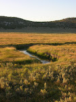
The landscape is open, what movie cowboys might call wide open, and brown shades predominate. All of the shades of brown are washed with a hot chalky white. Even the fault-block battlements, purple in the distance, are striated by chalky veins. The sky, normally indigo or blue-black, is tan.
Turning left from the Highway onto Shoshone Basin Road the truck immediately pulled dust around itself. I stopped to check the GPS. I use a Garmin Colorado handheld and it takes its time coming on, then I have to fiddle with the screen lighting if it’s daylight to see what’s there. I get a fix on my position and orient the topo. Between me and the border is a lot of grazing land. All the dirt roads go to new graze, most to scattered water troughs where the water is hauled in, but the roads are also used by semi’s pulling filled livestock trailers. The roads are rock and gravel based to support the weight in rare rainy weather and to give some permanence to these minor transport arteries. But dust blows in from topside and works its way up from the underbelly. There won’t be a way to avoid it.